Hovelange Menu de navigationmodifier
Localité dans le canton de RedangeBeckerich
projets correspondantsluxembourgeoisallemandcommune luxembourgeoiseBeckerichcanton de RedangeGrès de Luxembourgune gareligne de l'Attert
Hovelange
Sauter à la navigation
Sauter à la recherche
Cet article est une ébauche concernant une localité luxembourgeoise.
Vous pouvez partager vos connaissances en l’améliorant (comment ?) selon les recommandations des projets correspondants.
| Hovelange.mw-parser-output .entete.mapbackground-image:url("//upload.wikimedia.org/wikipedia/commons/7/7a/Picto_infobox_map.png") | ||||
 Le chêne remarquable | ||||
| Administration | ||||
|---|---|---|---|---|
Pays | ||||
Circonscription | Nord | |||
Canton | Redange | |||
Commune | Beckerich | |||
Code postal | L-8538 (Liste détaillée) | |||
| Démographie | ||||
Population | 260 hab. (12/07/2006) | |||
| Géographie | ||||
Coordonnées | 49° 43′ nord, 5° 54′ est | |||
| Localisation | ||||
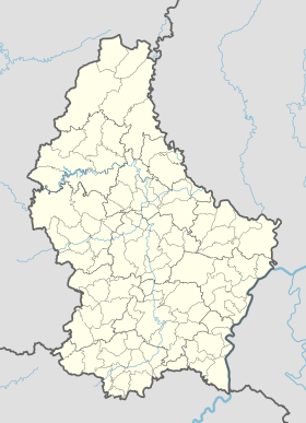
| Géolocalisation sur la carte : Luxembourg
Géolocalisation sur la carte : Canton de Redange
Géolocalisation sur la carte : Canton de Redange
| ||||
modifier | ||||


Hovelange (luxembourgeois : Huewel, allemand : Hovelingen) est une section de la commune luxembourgeoise de Beckerich située dans le canton de Redange.
Située en majeure partie à la base du Grès de Luxembourg, elle est abondante en sources dont plusieurs sont utilisées par une usine qui en fait le traitement, l'emballage et la vente en bouteilles.
Jadis, Hovelange était doté d'une gare se trouvant sur la ligne de l'Attert, abandonnée en 1969.

Vue générale
 Portail du Luxembourg
Catégories :
- Localité dans le canton de Redange
- Beckerich
(RLQ=window.RLQ||[]).push(function()mw.config.set("wgPageParseReport":"limitreport":"cputime":"0.368","walltime":"0.531","ppvisitednodes":"value":2995,"limit":1000000,"ppgeneratednodes":"value":0,"limit":1500000,"postexpandincludesize":"value":52901,"limit":2097152,"templateargumentsize":"value":6545,"limit":2097152,"expansiondepth":"value":23,"limit":40,"expensivefunctioncount":"value":6,"limit":500,"unstrip-depth":"value":0,"limit":20,"unstrip-size":"value":788,"limit":5000000,"entityaccesscount":"value":1,"limit":400,"timingprofile":["100.00% 482.083 1 -total"," 67.72% 326.449 1 Modèle:Infobox_Localité_du_Luxembourg"," 66.68% 321.431 1 Modèle:Infobox_Subdivision_administrative"," 14.99% 72.288 1 Modèle:Ébauche"," 14.53% 70.050 1 Modèle:Infobox/Géolocalisation_multiple"," 12.95% 62.406 3 Modèle:Infobox/Géolocalisation_multiple/Carte"," 12.13% 58.460 1 Modèle:Infobox/Ligne_mixte_latitude_longitude_optionnelle"," 11.56% 55.727 71 Modèle:Infobox/Ligne_mixte_optionnelle"," 8.81% 42.488 1 Modèle:Paronyme"," 8.39% 40.435 1 Modèle:Portail"],"scribunto":"limitreport-timeusage":"value":"0.140","limit":"10.000","limitreport-memusage":"value":6620674,"limit":52428800,"cachereport":"origin":"mw1308","timestamp":"20191125191815","ttl":2592000,"transientcontent":false););"@context":"https://schema.org","@type":"Article","name":"Hovelange","url":"https://fr.wikipedia.org/wiki/Hovelange","sameAs":"http://www.wikidata.org/entity/Q2125441","mainEntity":"http://www.wikidata.org/entity/Q2125441","author":"@type":"Organization","name":"Contributeurs aux projets de Wikimu00e9dia","publisher":"@type":"Organization","name":"Wikimedia Foundation, Inc.","logo":"@type":"ImageObject","url":"https://www.wikimedia.org/static/images/wmf-hor-googpub.png","datePublished":"2006-05-20T17:17:28Z","dateModified":"2019-09-25T12:26:08Z","image":"https://upload.wikimedia.org/wikipedia/commons/8/87/Hovelange_ch%C3%AAne_class%C3%A9.jpg","headline":"localitu00e9 luxembourgeoise"(RLQ=window.RLQ||[]).push(function()mw.config.set("wgBackendResponseTime":121,"wgHostname":"mw1269"););


